VERPAT Tutorial Scenario Planning
This section introduces scenario planning. What is it? Why is it done?
Scenario planning is a process to develop and analyze the future based on different assumptions about future uncertainties. A defining characteristic of successful public sector scenario planning is that it actively involves the public, the business community, and elected officials on a broad scale, educating them about growth trends and trade-offs, and incorporating their values and feedback into future plans. VERPAT is one of several analytical tools and models developed to support scenario planning.
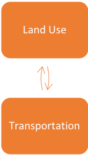
Scenario planning provides a framework for developing a shared vision for the future by analyzing the various forces that affect growth
- Health
- Transportation
- Economics
- Environmental
- Land use
- Helps agencies align informed and strategic transportation decision-making with regional goals
- Integrates regional transportation and local land use stakeholders to collectively better understand and visualize future transportation and land use patterns
- Improves public and stakeholder involvement through coordinated outreach
- Scenario planning software helps develop and assess scenarios and visualize the differences between alternatives
- Broadens agency and public understanding by exploring future challenges and opportunities
FHWA provides scenario planning technical assistance and guidebooks here. FHWA also offers workshops, webinars, innovative uses and other resources to assist transportation agencies to support scenario planning for local, regional or statewide activities.
- Peer Exchange Workshops
- FHWA Scenario Webinar
- Noteworthy Practices and Innovative Uses
- Publications and Resources
- Supporting Performance-Based Planning and Programming through Scenario Planning
|
 |
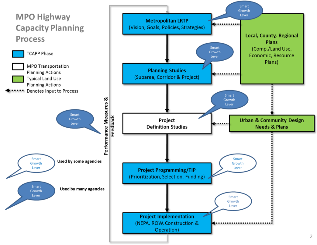
These process maps for state DOTs and MPOs highlight areas where smart growth levers can be used
|
 |
Most agencies are interested in scenario planning as a strategy to evaluate new policies for land use, pricing, new vehicle and information technologies and travel demand management. These are policies that are more difficult for most travel demand forecasting models.
Many agencies need coordination, cooperation, and communication with local governments on land use policy, since land use regulations are governed by local governments.
Agencies also want to understand
- Induced demand
- Travel demand management
- Urban form
- Congestion reduction
- Outcomes and performance
Background research in five areas provided the framework for VERPAT to address gaps in the research, where travel impacts are not directly observable.
| Topic | Well-Established Relationships |
Gaps in Research |
|---|---|---|
| Built environment impact on peak auto demand | Impact on daily travel | Impact by time of day |
| Mobility by mode and purpose | Impact on daily travel | Impact by trip purpose |
| Induced traffic and induced growth | Capacity expansion on an expanded facility | Route shifts, time of day shifts, mode shifts, induced trips, new destinations, growth shifts on the network; effects of operational improvements, land use plans |
| Relationship between smart growth and congestion | Localized effects | Macro-level or regional effects |
| Smart growth and freight | Freight is necessary for population centers | Impacts of loading docks, truck routing, full-cost pricing, freight facilities and crossings, inter-firm cooperation, stakeholder communication |
Land use scenarios are based on place types, determined by the type of area and the type of development.
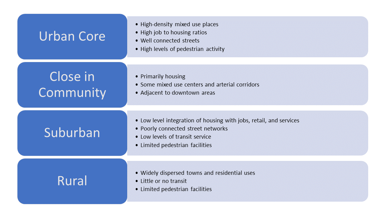
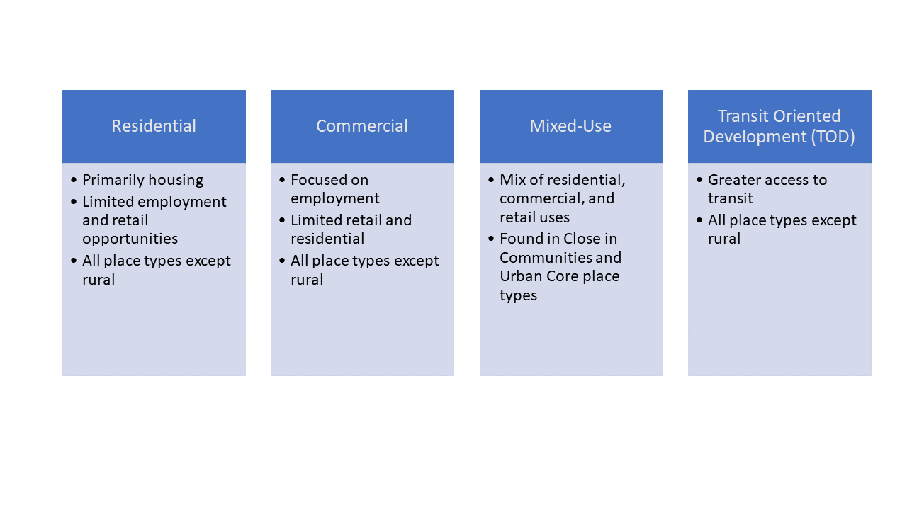
Built Environment: Location of population and employment by place type
| Development Type | Urban Core | Close in Community | Suburban | Rural |
|---|---|---|---|---|
| Residential | X | X | X | |
| Employment | X | X | X | |
| Mixed-use | X | X | X | |
| Transit Oriented Development | X | X | X | |
| Rural/Greenfield | X |
Transportation scenarios are based on changes in travel demand, transportation supply or transportation policies.
Travel Demand
- Trip-making, defined as auto trips per capita and the transit trips per capita
- Population, defined as persons by age for the base and future years
- Employment, defined as employees by firm size and industry and employment growth
- Household income, defined as regional average per capita income by forecast year in year 2000 dollars
- Auto and light truck proportions of VMT by year
- Truck and bus VMT by year
- Induced demand – short term impacts
Transportation Supply
- Amount of regional transit service, defined as bus and rail revenue miles
- Amount of roadway capacity, defined as freeway and arterial capacity
Transportation Policies
- Pricing, including vehicle use charges, such as VMT charges or gas taxes, and parking pricing.Vehicle use charges are considered as a factor of auto operating charges and parking pricing are considered as an additional cost at employment or other locations.
- Travel demand management (TDM), including vanpool, telecommuting, ridesharing, and transit pass programs.
- Intelligent transportation system (ITS), which estimates speeds with and without incidents. This computes an overall average speed by road type and congestion level. Each policy is implemented as an adjustment to VMT based on the policy inputs.
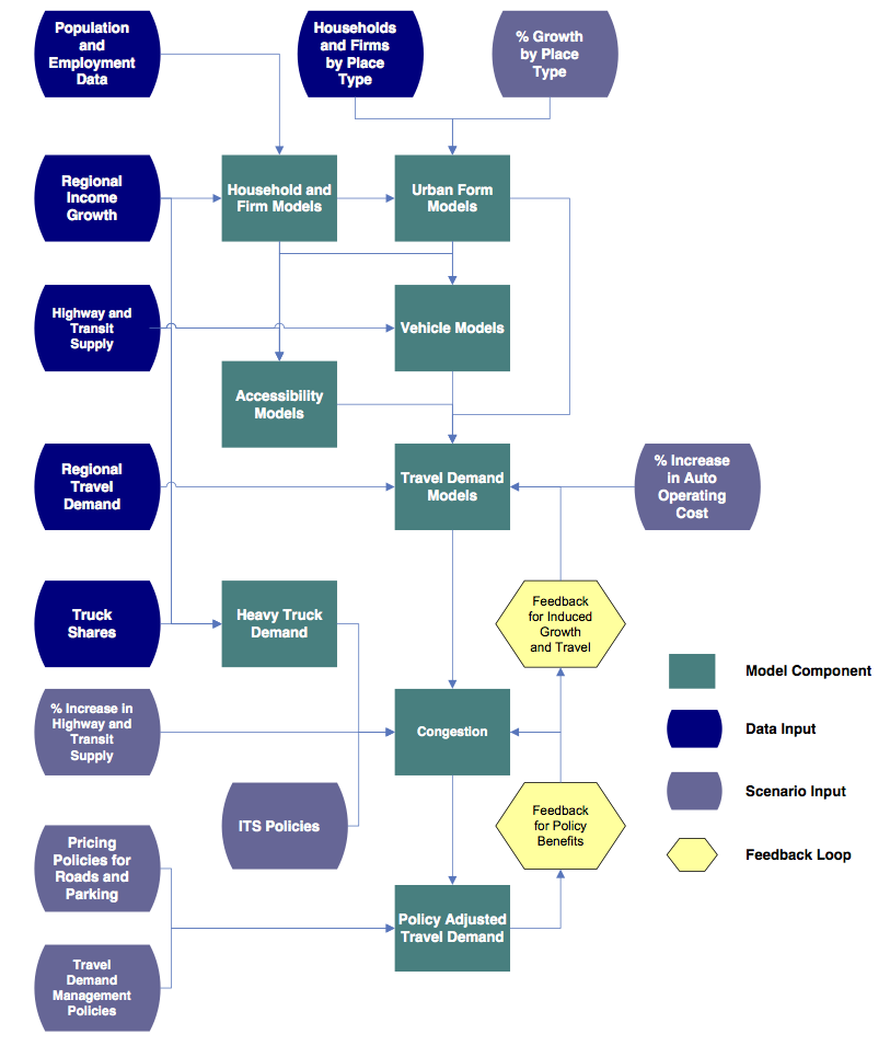
VERPAT is an example of a strategic model developed to test policies, infrastructure investments and changes in demographics. These models support strategic planning efforts by allowing users to consider hundreds of possible scenarios easily. VERPAT combines higher level analysis of the transportation supply with individual characteristics of travel demand, built environment and policies such as:
- Growth by place type
- Households (persons by age and income)
- Firms (employees and industry)
- Income growth
- Truck and bus VMT
- Accessibility
- Congestion
- Induced growth
- Policy benefits
Strategic models bridge the gap between regional visioning and specific plans 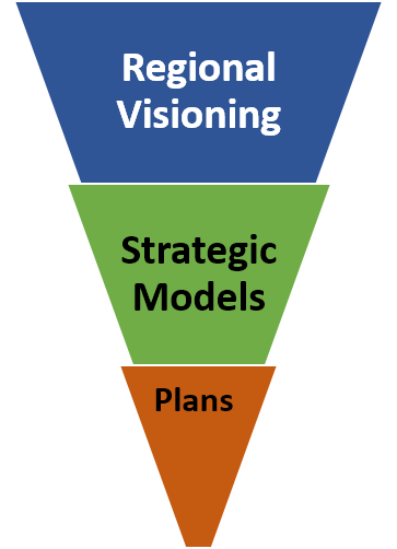
VERPAT is a disaggregate policy model that predicts travel demand impacts at an individual household level.
Evaluate scenarios across a range of performance metrics
- Travel Impacts
- Daily VMT
- Daily vehicle trips
- Daily transit trips
- Average travel speeds by vehicle type
- Vehicle hours of travel and vehicle hours of delay
- Environmental and Energy Impacts
- Fuel consumption
- Greenhouse gas emissions
- Financial and Economic Impacts
- Regional highway infrastructure costs
- Regional transit infrastructure and operating costs
- Annual traveler cost, including fuel cost, fuel tax, parking cost and VMT charges
- Location Impacts
- Regional accessibility based on place types
- Community Impacts
- Accidents, including fatalities and injuries and property damage costs
- Walking percentage increase
- Job accessibility by income group
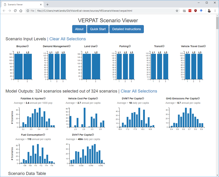
Compare multiple scenarios at a time graphically to quickly assess results
The next section in the tutorial is the VERPAT Model Description.