This Github repository contains the code and data used to produce visualisations of the bicycle and pedestrian counter data in Zuirch. It is a fork of the overall Mobv project, which you can find here.
In this repository you can find visualisations for Zurich, for the year 2020 here. The purpose of this fork is to allow discussions of Open Data and FAIR software princples with students of the Geo372 course.
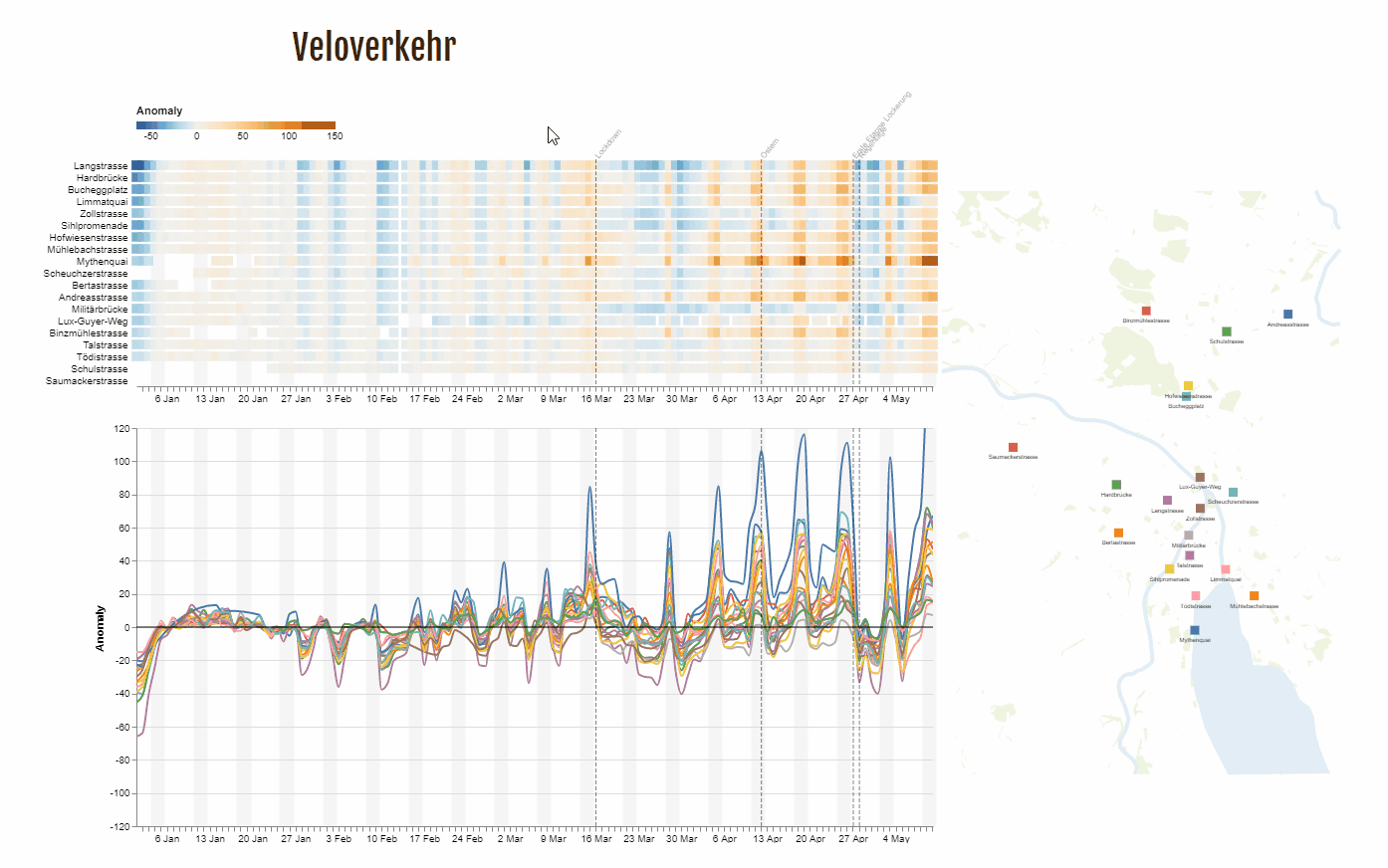
How are we moving around our cities while facing a global pandemic? How have lockdowns affected movement? How do we accommodate urban travel that requires social distancing? Using sensors from open data sources, we visualize movement of people. Visualization reveals the role of weather, day of week, leisure, exercise and utility travel needs and compliance in lockdown measures. It helps to anticipate transport planning needs for a safe, sustainable urban travel future.
The visualizations encompass dynamic heatmaps displaying traffic counts for an individual day. The heatmap is linked to a geographic map displaying the counter locations as well as to a line graph showing anomalies (the so-called Chi values) in traffic volume over time. We wouldn't have been able to implement our visualisations without the Open Data. Many thanks to administrative bodies for providing data and documentation and to OpenStreetMap contributors for mapping data.
This repository contains:
- data specifications
- data analysis code
- data as well as
- visualization and front-end code ... necessary for you to build your own Urban Mobility Viewer. All code is open under the GNU General Public License v3.0. Data sources are listed in each directory. Zurich data are available as Open Data.
Conceived and implemented by