Hydro Engine is a small service and a command-line tool built on top of Google Earth Engine that allows querying various hydrological variables, useful as an input for hydrological models.

The command-line Python tool can be installed using the following commands:
> pip install hydroengine
Once the package is installed, you can use hydroengine command to download input data needed for your hydrological model.
Upstream catchments, rivers and various raster variables can be queried using following commands:
> hydroengine region.json --get-catchments catchments.json
> hydroengine region.json --get-rivers rivers.json
> hydroengine region.json --get-raster dem dem.tif 1000 EPSG:4326
> hydroengine region.json --get-lakes lakes.json
> hydroengine region.json --get-lake-variable 183160 water_area area.json
See examples/run.sh, showing how different data types can be downloaded.
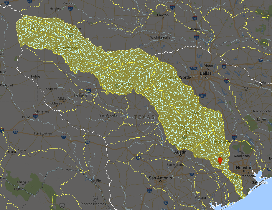
All data types can be queried for an input area or location (GeoJSON polygon geometry). A polygon may define a flood location. For example, in the figure below, a single point near Houston is used to query upstream catchments and a drainage network, providing runoff water for that location.
Supported functionality:
- Querying upstream catchments as a single or multiple polygons. Source: HydroBASINS
- Querying upstream drainage network as polylines. Source: HydroSHEDS
- Querying raster variables:
- dem [m] - in meters, source: 30m SRTM v4
- hand [m] - Height Above the Nearest Drainage (HAND)
- FirstZoneCapacity [-] - ?
- FirstZoneKsatVer [-] - ?
- FirstZoneMinCapacity [-] - ?
- InfiltCapSoil [-] - ?
- M [-] - ?
- PathFrac [-] - ?
- WaterFrac [-] - ?
- thetaS [-] - ?
- soil_type [-] - soil type, based on ?
- landuse [-] - land use type, based on MODIS 500m
- LAI01...LAI12 - leaf area index monthly climatology, source: eartH2Observe