Collection of hiking maps, optimized for mobile use, based on OSM data.
npm install
gulp
gulp develsudo apt-get install python-gdal gdal-bin
npm install -g topojson- Create a directory named
./data/. - Download tiles from https://earthexplorer.usgs.gov/, from the SRTMGL1v003 dataset. They come as
.hgt.zipfiles. Unarchive the files and place the.hgtfiles under./data/srtm-hgt/. - Run
maketo convert the files totifand create a mosaic file. - Create a folder named
./data/contours/.
Create map for specific region, eg. for Piatra Craiului (crai):
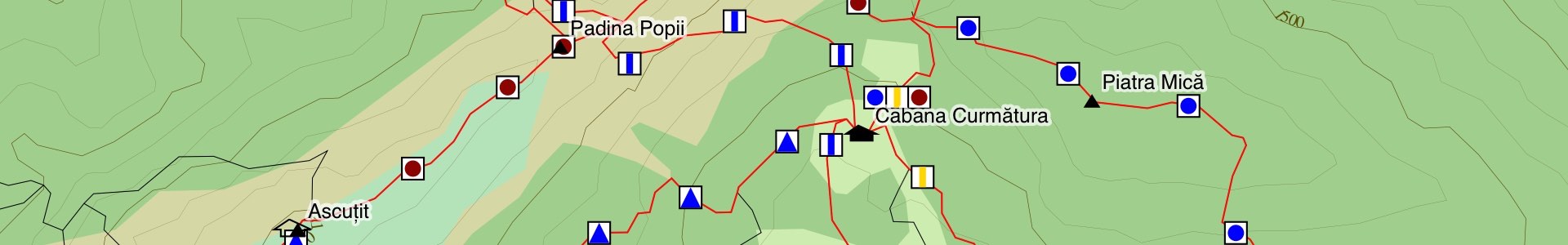
gulp data-crai # "crai" is the region nameFor each region, we query Overpass, filter the results, and convert them to TopoJSON. Elevation contours are from SRTM. We then package all data for a region as JSON, the largest is almost 1MB, and they compress to ~30% of the original size with gzip. In the browser, we save the data in appcache, and render the map as SVG, using D3.js and lots of creativity :)
Code is licensed as MIT. Data is © OpenStreetMap contributors, except for contour lines, which come from NASA's SRTM dataset.