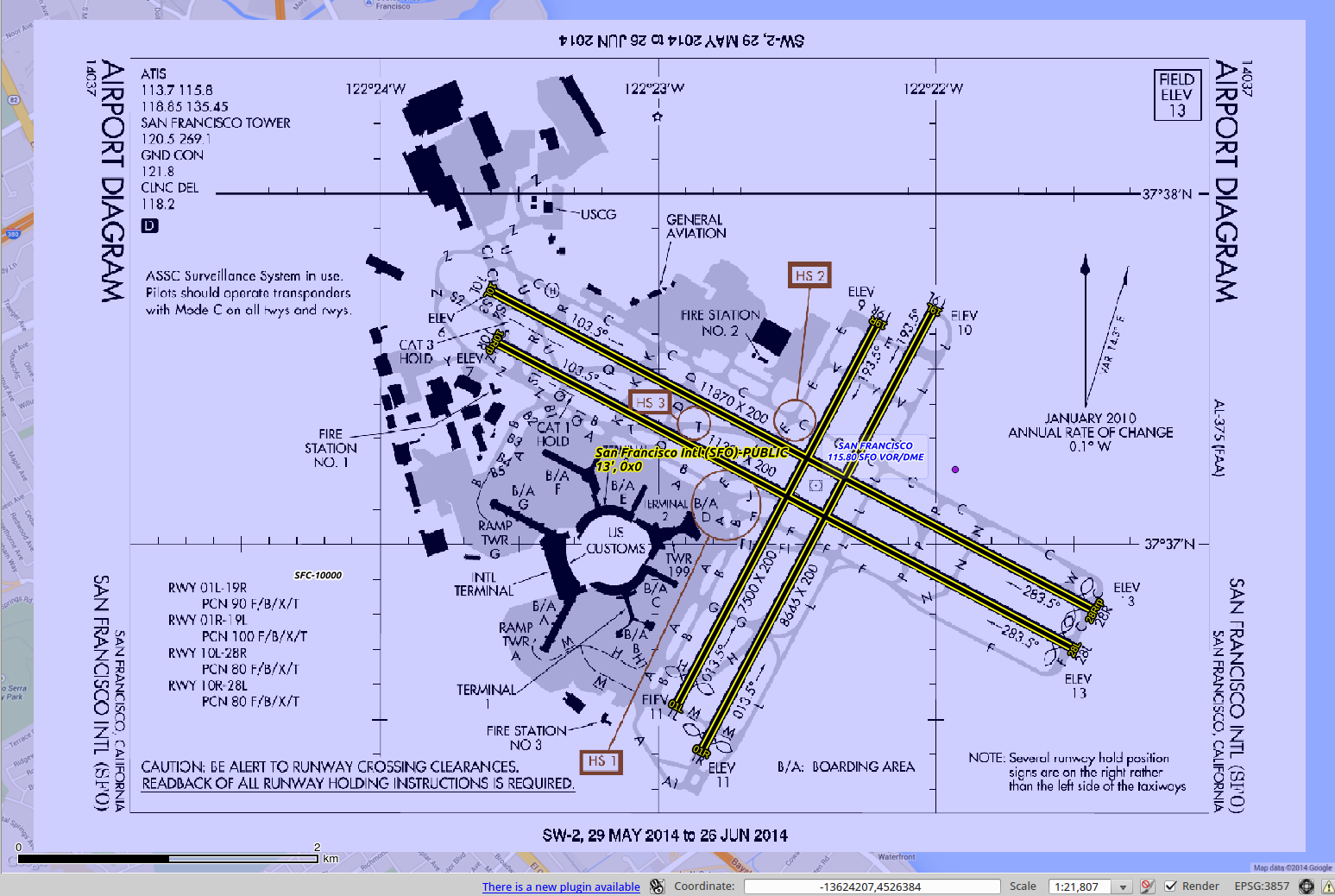
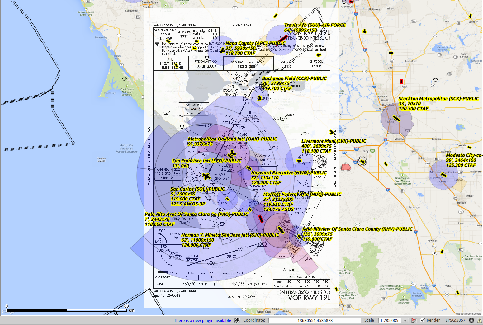
Create Georeferencing information for Instrument Approach Procedures and Airport Diagrams
Note that the FAA has started providing georeferencing in the PDFs for approach plates so this utility is no longer needed for them. However, it is still useful for airport diagrams which are not referenced.
These instructions are based on using Ubuntu (or some other Debian variant)
Enable the "universe" repository in "Software & Updates" section of System Settings and update

Install git
	sudo apt-get install git

Download the repository
	git clone https://github.com/jlmcgraw/GeoReferencePlates

Execute the setup.sh shell script
	./setup.sh

Download some Instrument Approach Procedure plates and initialize the database
	- Download these with the "load_dtpp_metadata.pl" file
		This will also re-initialize the dtpp.db file, be careful

	- A download of all plates will probably take several hours

Requires a database containing lat/lon info
	(This is created by another of my projects at https://github.com/jlmcgraw/processFaaData)

Requires perl version > 5.010
To georeference instrument procedures:
	 ./georeferencePlatesViaDb.pl <options> <directory_with_PDFs>
		-v debug
		-a<FAA airport ID>  To specify an airport ID
		-i<2 Letter state ID>  To specify a specific state
		-p Output a marked up version of PDF
		-s Output statistics to dtpp.db about the PDF
		-c Don't overwrite existing .vrt
		-o Re-create outlines/mask files
		-b Allow creation of vrt with suspected bad lon/lat ratio
		-m Allow use of non-unique obstacles

To georeference airport diagrams:
	Usage: ./georeferenceAirportDiagramsViaDb.pl <options> <directory_with_PDFs>
		-v debug
		-a<FAA airport ID>  To specify an airport ID
		-i<2 Letter state ID>  To specify a specific state
		-p Output a marked up version of PDF
		-s Output statistics to dtpp.db about the PDF
		-c Don't overwrite existing .vrt

-p will create two extra files:
	 marked-*.pdf
		Shows how the ground control points were matched
		A green circle indicates which were used

	 gcp-*.png
		Uses lon/lat information from the database to draw the ground control points.  If the red dots don't seem to match up with a feature (obstacle, fix, nav aid) the georeference probably wasn't accurate
		The green dot is the airport lon/lat
The first time the utility is run for a particular PDF it will take longer as it is generating the corresponding PNG and mask files. These will not be created again if they exist
A first run for all plates may take a day or two, subsequent runs will be much shorter
Create/refresh the NASR and CIFP databases

	https://github.com/jlmcgraw/processFaaData
	https://github.com/jlmcgraw/parseCifp

Create empty ./dtpp folder

./load_dtpp_metadata.pl . 1409
	Download DTPP XML catalog, create DTPP database and download procedures.  Change cycle number as needed

./georeferencePlatesViaDb.pl -m -p -s ./dtpp/

./georeferenceAirportDiagramsViaDb.pl -p -s ./dtpp/
This software and the data it produces come with no guarantees about accuracy or usefulness whatsoever! Don't use it when your life may be on the line!
Thanks for trying this out! If you have any feedback, ideas or patches please submit them to github.
-Jesse McGraw jlmcgraw@gmail.com
DISTRIBUTION
Users are prohibited from any commercial or non-free resale use without explicit written permission from Jesse McGraw. Users should acknowledge this project as the source used in the creation of any reports, publications, new data sets, derived products, or services resulting from the use of this data set. I also request reprints of any publications and notification of any redistributing efforts. For commercial access to the data, send requests to Jesse McGraw jlmcgraw@gmail.com.
NO WARRANTY OR LIABILITY
I provide these data without any warranty of any kind whatsoever, either express or implied, including warranties of merchantability and fitness for a particular purpose. I shall not be liable for incidental, consequential, or special damages arising out of the use of any data.
ACKNOWLEDGMENT AND CITATION
I kindly ask any users to cite this data in any published material produced using this data, and if possible link web pages to the github website (http://github.com/jlmcgraw).

