This is a fork of the OpenStreetMap Carto map style implementing a different color scheme, various improvements regarding path, road and water feature rendering and overall a different approach to cartographic design.
The following are the major design differences of this style compared to OpenStreetMap Carto:
- a different low to mid zoom color scheme that is used without algorithmic color fading and that therefore allows more conscious color design choices.
- various changes in the landcover color scheme matching the cartographic principles (see below).
- a three color system for waterbody rendering.
- low zoom waterbody rendering based on preprocessed data.
- extensive redesign of waterbody rendering in general including distinct rendering of intermittent and saltwater waterbodies and waterways.
- different color for administrative boundaries, distinct rendering of maritime boundaries.
- changed road colors with purple motorways and yellow tertiary roads
- different color scheme and different design of
path/footway/cyclewayrendering as well astrackrendering at mid zoom levels. - more sophisticated rendering of waterway barriers (dams, lock gates, weirs and waterfalls) as well as fords.
- different rendering of springs and addition of rendering of other water related point features.
- different color for transportation and accomodation related point symbols.
- different patterns for woodland and differentiated rendering of
leaf_cycle. - rendering of implicit embankments and cuttings (
embankment=yes/cutting=yes) in highways, railways and waterways - rendering of archipelagos based on convex hull
- rendering of various farmland and orchard types with special patterns
- rendering of
landuse=salt_pond - rendering of
natural=ridgeandnatural=aretewith a linear structure pattern - golf course rendering derived from the French style
- rendering sport type on pitches using single symbol patterns
- rendering of entrances in barriers mapped with nodes
- complete re-design of the road rendering framework with:
- ground unit width rendering of roads
- lane depiction on roads
- rendering of implicitly mapped sidewalks on roads
- rendering of implicitly mapped streetside parkings and parking/cycle/bus lanes
- differentiated rendering of turning circles, turning loops, mini roundabouts and passing places
- rendering of details on steps
- differentiation of unpaved roads
- new access restriction semantics based on primary mode of transport and additional permissions
- display of additional permissions on road classes with implicit access restrictions
- rendering of
natural=tree,natural=shrub,natural=tree_rowandnatural=hedgedifferentiated byleaf_type/leaf_cycle - embankment like illustration of
hedge=hedge_bank - a modular style definition with different layers in separate files and the possibility to define style variants like with simplified versions of specific high complexity layers.
- script generated MSS/SQL code for the POI symbol and label rendering making the style scale better with a large number of POI types.
- regionally differentiated font lists for label rendering to better conform with different regional typographic conventions (using preprocessed administrative area polygons for lookup).
- rendering of compound name labels in multilingual regions based on matching
name:<lang>tags with parts of thenametag and interpretingdefault_languagetags. - rendering of
natural=earth_bank,natural=gullyandnatural=crevasse - differentiated rendering of
natural=earth_bankwithearth_bank=grassy_steep_slopeandnatural=cliffwithsurface=ice - rendering of
man_made=dykewith line signature parametrized according towidthtagging - differentiated rendering of
barrier=fence,barrier=guard_rail,barrier=wall,barrier=retaining_wallandbarrier=ditch. - rendering of
barrier=wall,barrier=retaining_wallandbarrier=ditchandbarrier=city_wall/historic=citywallsparametrized according towidthtagging - distinct rendering of
barrier=wallandbarrier=retaining_wallforheight<=0.5 - rendering of different types of parking spaces using single symbol patterns
- rendering of surface type on parkings using a structure pattern
- symbol augmentation for parkings illustrating secondary tags
- symbol augmentation for bus/tram stops with a shelter
- rendering some types of buildings with a distinct design at high zoom levels (
building=roof,building=greenhouse,building=garages,building=garage,building=carport) - rendering of street lights with a design derived from the french style
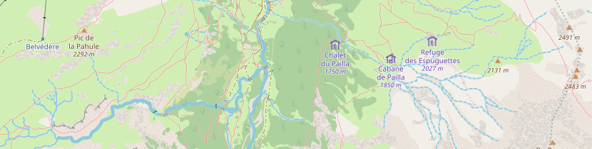
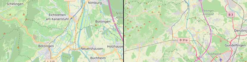
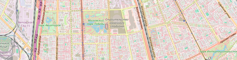
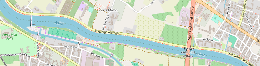
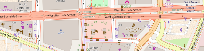
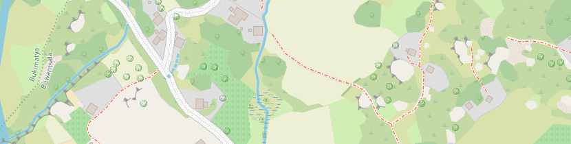
There is a collection of sample rendering available for a more extensive impression of the looks of this style on https://imagico.de/map/ac_samples_en.php
CARTOGRAPHY.md outlines the guiding principles of cartographic design in this project.
This style is not regularly synchronized with upstream changes but I occasionally integrate changes that fit into the design concept here.
See INSTALL.md for the generic OSM-Carto installation instructions. In addition you need to install the a number of functions in PostGIS supplied in:
sql/z.sqlsql/line-widths-generated.sqlsql/map_functions.sqlsql/roads.sqlsql/names.sqlsql/symbols.sql
Be aware that this style does not work well together with Postgresql JIT optimization. It is highly advisable to turn that feature off in your Postgresql configuration.
Also the newest changes depend on a custom version of Carto. If you don't want to use that you can remove the XML code within CartoCSS code in symbols-labels.yaml but you will loose the features that depend on that of course. How you can modify kosmtik to use a custom local version of carto can be found here.
Symbol augmentation used for rendering some symbols depends on a custom extension of Mapnik. You can use the style without it, but will get some warnings and will not be able to use the symbol augmentation.
For rendering all languages as intended you also need to download custom fonts - for which i adapted the
get-fonts.sh from upstream. To get just the AC-Style specific fonts you can run the script without parameters,
to get all the fonts used by OSM-Carto run get-fonts.sh all.
The style uses a new, modular concept for setting up the rendering layers that allows specifying different variants and simplified versions of layers that are expensive in rendering.
scripts/assemble_project.py -t simple
is going to be the way to invoke that. This feature has not been finalized yet.
Design components of the project are subject to the Creative Commons Attribution ShareAlike 4.0 (CC BY-SA 4.0) License.
Software components of the project are subject to the GNU Affero General Public License as published by the Free Software Foundation, either version 3 of the License, or (at your option) any later version.
See LICENSE.txt for details.