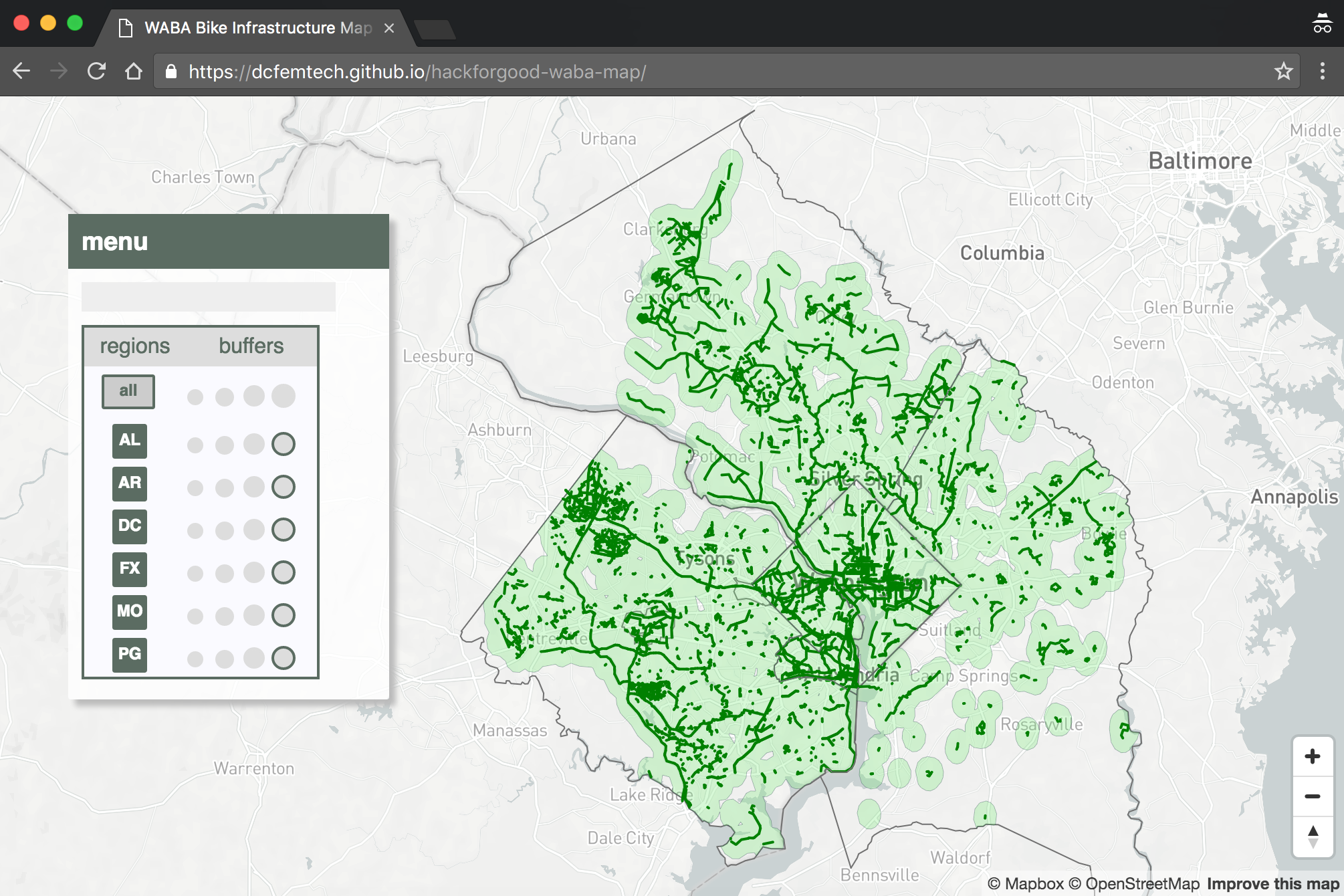
https://dcfemtech.github.io/hackforgood-waba-map/
This project is managed with npm - you will need to first install Node and NPM. We recommend using the Node Version Manager (nvm) or nvm-windows to install and manage Node.
Once you've installed Node, to run this project:
- Clone the repo locally:
git clone https://github.com/dcfemtech/hackforgood-waba-map.gitorgit clone git@github.com:dcfemtech/hackforgood-waba-map.gitdepending on your git setup - Change into the directory:
cd hackforgood-waba-map - Install dependencies:
npm install - Start the project:
npm start
At the moment there are no tests. Nevertheless, if you run npm test this will lint for code style using eslint.
| Location | URL | Description |
|---|---|---|
| Montgomery County, MD | Bikeways from dataMontgomery | Filtered by category = "Paved Off-Road Trail" or "Bike Lanes" or "Separated Bike Lanes" |
| Fairfax County, VA | Bicycle routes from Fairfax GIS Data and County Trails from Fairfax GIS Data and Non-County Trails from Fairfax GIS Data | Routes filtered by STATUS = 'Bike Lane', Trails filtered by SURFACE_MATERIAL = 'Asphalt' or SURFACE_MATERIAL = 'Concrete' |
| Arlington County, VA | Bike routes from Arlington County GIS Data | Filtered by Route_Type = "Off Street Trail" or "Marked Route". |
| Alexandria City, VA | Bike trails from Alexandria Open GIS Data Portal | Filtered by (TRAILTYPE = "Off Street" or "On Street") and SHARROW = "No" |
| Prince George's County, MD | Master Plan Trails from PG Planning Open Data Portal | Filtered by FACILITY_S = "Existing" AND "FACILITY_T = "Bike Lane" OR "FACILITY_T" = "Hard Surface Trail" |
| Washington, DC | Bicycle Lanes from opendata.dc.gov and Bike Trails from opendata.dc.gov | Filtered by FACILITY = "Existing Bike Lane" OR "Climbing Lane" OR "Contraflow Bike Lane" or "Cycle Track" |