NASA launches anually a huge amount of airborne projects, wich recollect a lot of data, and interact with lots of commercial planes.
Sadly, those programs dont't have as much visibility as they should. Also, old flight data is not easily accesible and has not a good representation.
This project covers those problems and more by:
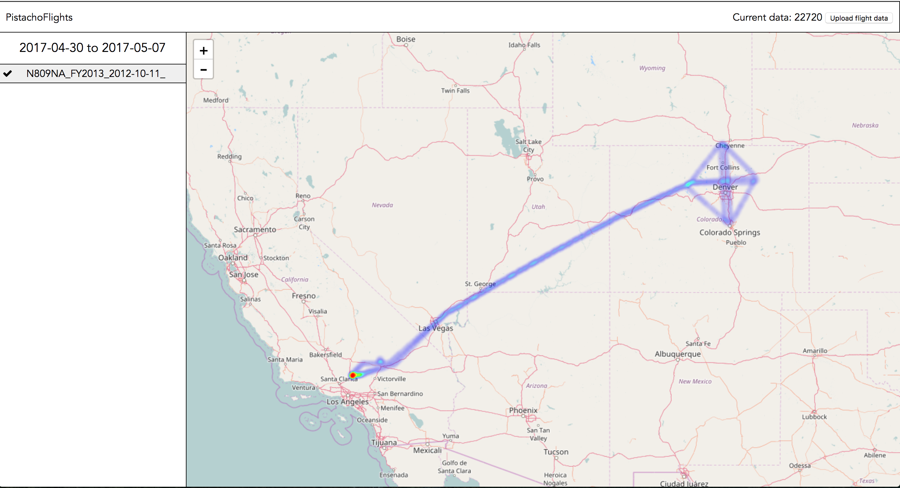
- Creating a nice flight map, with all data from the beginning
- Adding commercial flight routes
- Added a flight heatmap, for potentially showing the range of the data collected by the sensors. As that data is usually most clear for each project's researchers, this allows them to manipulate the heatmap for it to be more precisa
- Adding real time flight data
- Allowing users to upload their own flight data, so they can fly their own aircrafts (drones, data from personal jets...)
- Allowing users to modify flight data
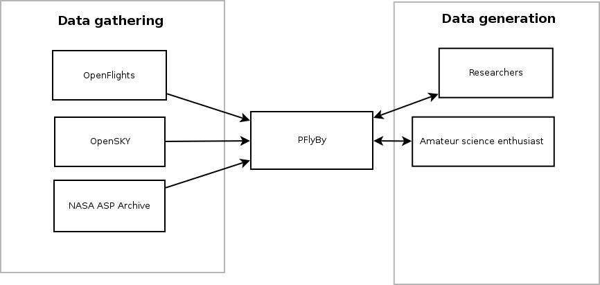
Right now, the following data flow is implemented: