This Leaflet map displays USGS earthquake data for the last 30 days, with marker size dependent on magnitude and color scale dependent on depth of earthquake. The map has both a street view layer and a stamen terrain layer.
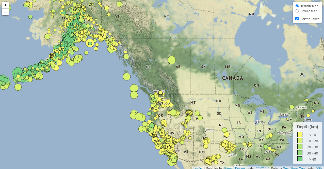
Data obtained from the USGS