Map coloring, using four colors
This program gets a map image as an input and produces all possible valid colorings of that map using backtracking.
The input image background and borders should be white.
- Detecting all non-white regions (eg. provinces or states).
- Converting the input map to a simple planar graph: There will be a node for each region. Two nodes will be adjacent, if and only if their corresponding regions have a common border on the map.
- Using backtracking for coloring that graph (it's a recursive function that produces all valid colorings).
- Displaying all produced colorings on the given map.
Install numpy, matplotlib and opencv using pip.
pip install -r requirements.txt
python3 map_coloring.py map_image_file_name
python3 map_coloring.py iran.jpg
The original image:

A part of the program output:

python3 map_coloring.py tehran_province.jpg
The original image:

A part of the program output:

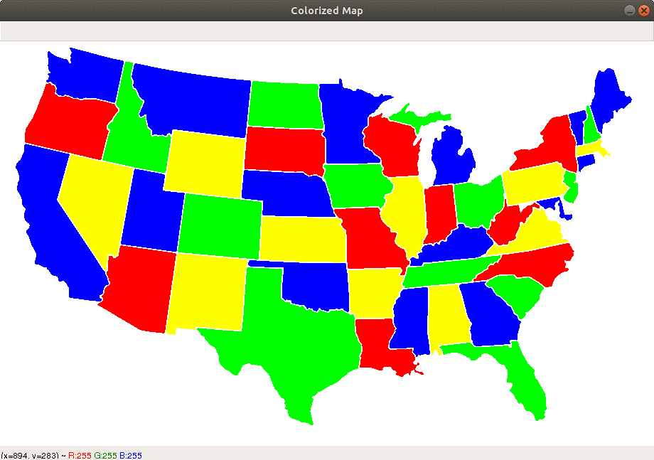
python3 map_coloring.py usa.png
The original image:

A part of the program output:
It runs slowly on large images. It can be improved by changing the second part of its algorithm (about setting the graph edges). Some computational geometry knowledge about polygons may be needed for this part.
Any contributions are welcomed.