Skip to content

The Uzbekistan map displays regions and districts using GeoJSON, ensuring smooth interaction and quick loading. Explore geographical boundaries effortlessly.

Notifications You must be signed in to change notification settings

AydosJs/uzbekistan-GeoJSON-map

Folders and files

NameName
Last commit message
Last commit date

Latest commit


History

5 Commits


Repository files navigation

GeoJSON - Data Visualization of Uzbekistan

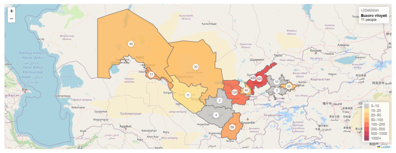
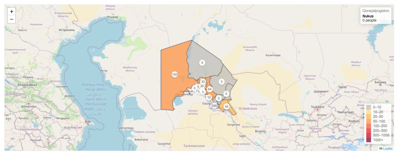
This JavaScript application displays a **GeoJSON** map of Uzbekistan colored by various population data for different regions and districts. By selecting a region, users can view data for the districts within that region. The application includes data for all regions and districts of Uzbekistan.

Features:

  • Interactive GeoJSON leafletjs map of Uzbekistan
  • Regions and districts colored by population data (change "population" to the specific data type you're using)
  • Ability to view data for districts within a selected region
  • Comprehensive data for all regions and districts

About

The Uzbekistan map displays regions and districts using GeoJSON, ensuring smooth interaction and quick loading. Explore geographical boundaries effortlessly.

Topics

Resources

Stars

Watchers

Forks

Releases

No releases published

Packages

No packages published