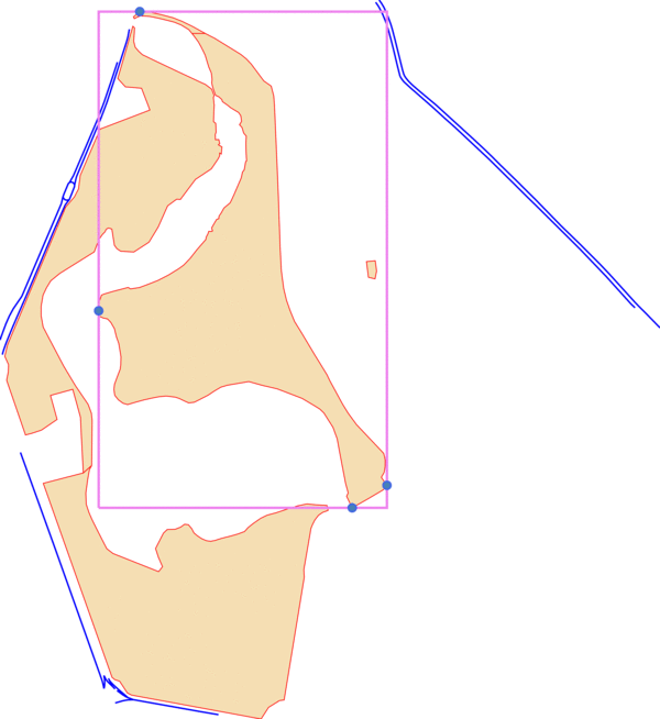
This is an algorithm for land subdivision under certain constraints. The goal is to cut a corner of a given area from a polygon. The corner that is cut is the one closest to a nearby road. The current version includes code to render the existing data in SVG format for development purposes. See this post for further details.
The implementation is expected to work on
- PostgreSQL >= 9.4.7
- PostGIS >= 2.2.2
You can find some test data for this in data/plan.dump.
Program descriptions:
| Program | Usage |
|---|---|
| schema.sql | Creates tables to hold the data |
| load.sql | Transfers some test data from OSM to the parcel and road table |
| cut.sql | Runs the parcel splitting algorithm |