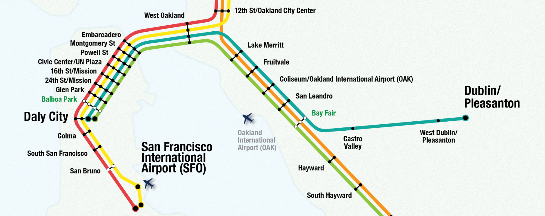
An open source BART system map I designed in 2012 for developers who want to include a simple BART map in their applications.
2017-09-02 (current)
- Added Warm Springs/South Fremont station
- Removed reference to AirBART bus service, as it's been discontinued
- Edited a few station names
- Cleaned up the legend
- Reduced width of map
- Reduced opacity of base map from 40% to 25%
- Reduced stroke from 3 pt to 1 pt on transfer stations
2012-04-25

- First version of map
The 'app map' is available on github and BART's website in AI and .png formats.
Use the AI file to change the base map, line colors and widths, fonts, etc.

Pull requests with updates are welcome.
Did you do something cool with this map or use it in your app? Email me at trucy@blinktag.com and I'll add it to the list.
Trucy Phan
This work is licensed under a Creative Commons Attribution 3.0 Unported License.