This is a tool to interactively generate heatmaps of the time to reach other stations from one chosen station.
This project has been developped with the Paris public transports network in mind, precisely the RATP part of its network.
There has been some choices made in the structuration of the data while writing the code and reading the RATP files, and it should pose some problems with other data sources.
But it should be adaptable if jumping in the code do not scare you too much. The file that handles every data types from the input data is here
The initial data for the stations, timetables, and transfers is taken from here: https://data.ratp.fr/explore/dataset/offre-transport-de-la-ratp-format-gtfs/information/
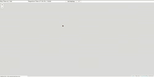
There two input option when interacting with the map:
- Max time (in seconds): to consider as the maximum limit for transport time between each station and chosen initial station.
The color code is derived from this value, as:- green: <= 1/3 of Max time
- yellow: > 1/3 and <= 2/3 of Max time
- red: > 2/3 of Max time
(The colors are configurable in this function)
- Departure Time: to consider as the starting moment from which to traverse the graph of stations. The time to reach one station at 17h00 should be different at 4h00.
There is one button next to the Get Heatmap one, to display the paths taken to reach all considered station, instead of the stations. The color code is taken from the one for the normal heatmap.
Use the correct binary from the Release page, and skip to step 5. (Download ratp archive step)
- Install golang: https://github.com/golang/go/wiki#working-with-go
- There should be a correct installation ready with $GOPATH set and your go binary in your $PATH. It did takes some time for me to do a complete and correct install.
git clone https://github.com/antonin-lebrard/heatmapTransport.gitin your$GOPATH/srccd heatmapTransportgo build -o heatmap .- Download the full GTFS archive from RATP here, its the
RATP_GTFS_FULLlink. - Extract the archive and take the
stops.txt,stop_times.txt,transfers.txtfiles and put them inheatmapTransport/ratp - Now execute
./heatmap. It will takes a long time (and RAM, like ~4Go of it) to gather all the necessary data and construct an adapted graph format.- Optionnaly, I've uploaded the zipped version of
graph.txthere, it's 500 Mo, but you might prefer taking this route if you have a good connection, and want to do something else in the meantime. - This step has taken me ~1h30 to do, but at the end of it, it will save the graph into a gigantic text file (1.6 Go for me) which will only takes 20 seconds to reload at the next launch
- Optionnaly, I've uploaded the zipped version of
When ./heatmap has finished loading the GTFS data and saved its graph to disk (or read it back), the application will open a server which the mapDisplayJs part of this project will use.
You can directly launch it with the file:/// url in your browser, for me it would be file:////home/antonin/go/src/heatmapTransport/mapDisplayJs/index.html
Thanks to the OpenTripPlanner (OTP) project and its technical documentation, particularly its Bibliography page
which helped me to realise this might be possible.
Thanks to leaflet as usual the simplest tool to present simple data on a map.