The GrIML processing package for classifying water bodies from satellite imagery using a multi-sensor, multi-method remote sensing approach. This workflow is part of the ESA GrIML project, and this repository also holds all project-related materials.
The GrIML package can be installed using pip:
$ pip install griml
Or cloned from the Github repository:
$ git clone git@github.com:PennyHow/GrIML.git
$ cd GrIML
$ pip install .
GrIML proposes to examine ice marginal lake changes across Greenland using a multi-sensor and multi-method remote sensing approach to better address their influence on sea level contribution forecasting.
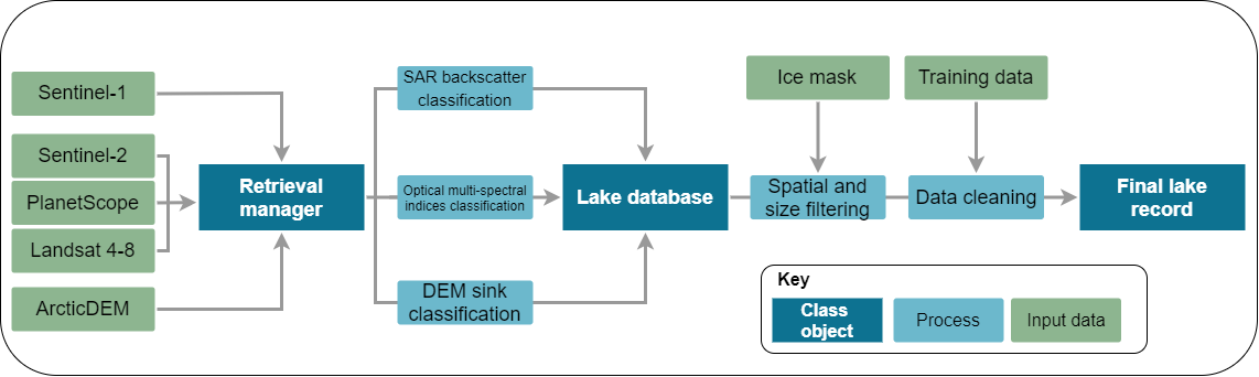
Ice marginal lakes are detected using a remote sensing approach, based on offline workflows developed within the ESA Glaciers CCI (Option 6, An Inventory of Ice-Marginal Lakes in Greenland) (How et al., 2021). Lake extents are defined through a multi-sensor approach using:
- Multi-spectral indices classification from Sentinel-2 optical imagery
- Backscatter classification from Sentinel-1 SAR (synthetic aperture radar) imagery
- Sink detection from ArcticDEM digital elevation models
-
ESA project outline and fellow information
-
Information about the ESA Living Planet Fellowship
-
2017 ice marginal lake inventory Scientific Reports paper and dataset