A prototype pattern for supporting light, dark, high contrast, and other color schemes in ArcGIS web maps.

- Demo code: demo
- Detailed spec: Spec.md
- Content resources, including templates and demo content: Cartography.md & ArcGIS Online
- Walkthrough (keep reading)
🗣 Coming from the Demo Theater? Your feedback is wanted. Please let us know what you think in this short five-question survey
Until recently, most apps only supported a dark-on-light color scheme. This retina-scorching reality was shattered in 2019 with the parallel developments of system-wide Dark Mode support in iOS 13, prefers-color-scheme in CSS, and system-wide support in Android 10. Windows 10 natively supports dark mode as do many Linux desktop environments.
The time is now to support dark mode
Beyond support for dark mode, Esri has identified accessibility as a priority for our products. High contrast is an accessibility feature that makes it easier for users to see boundaries between elements and read text. Many operating systems, including Windows and macOS support a high contrast mode.
The time is NOW to support High Contrast mode
Support for light, dark, and high contrast modes is not without precedent among mapping applications.
Apple Maps:
| Light | Dark |
|---|---|
 |
 |
Google Maps (navigation only):
| Light | Dark |
|---|---|
 |
 |
Bing Maps:
| Light | Dark |
|---|---|
 |
 |
Support for High Contrast mode is more limited, but Bing Maps offers at least one example on Windows:
| Default | High Contrast |
|---|---|
 |
 |
In the absence of core platform support for a feature, common patterns are used to enable common mapping features.
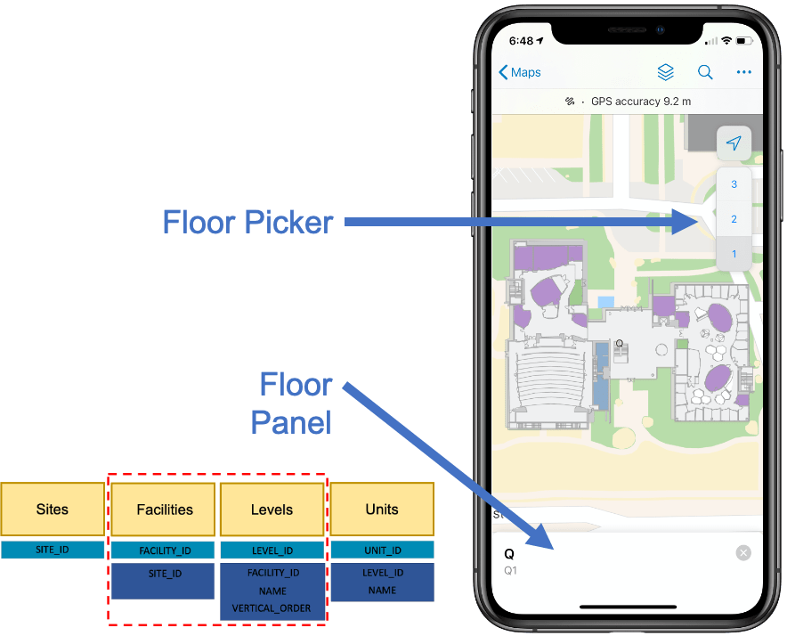
One of the most common patterns is support for a floor switcher using a feature layer definition expression. More recently, ArcGIS Indoors has formalized floor support in the ArcGIS Indoors Information Model. Any app working with ArcGIS Indoors can rely on facilities having a LEVEL_ID to enable a floor picker; Field Maps demonstrates this.
This repo proposes a new pattern for supporting themes in ArcGIS. Details of the proposal are defined in Spec.md, summarized below:
- Web & mobile maps & scenes are authored with top-level
GroupLayerentries- Each group layer corresponds to a specific theme, and is named as such
- Contents of each layer should be identical, with the exception of styling/theming
- Any mapping application can show the full contents of the map without causing problems
- Theme-aware applications will hide the top-level group layers for all but the currently-selected theme
- Theme-aware applications can select a theme automatically
- Best practice (in general, not specific to ArcGIS) is to always allow user choice
- The desired 'default' group should be visible by default; all others should be hidden by default
- The pattern defines
Light,Dark, andHigh Contrastthemes- Additional themes can be defined (e.g.
Red,Solarized, etc.)- Web map metadata can include properties to identify non-standard themes to use for Light, Dark, and High Contrast modes
- Maps can define any number of variations; a map supporting
Darktheme is not required to supportHigh Contrast
- Additional themes can be defined (e.g.
Like any pattern-based mapping feature, there are benefits and drawbacks.
Benefits:
- Maps authored in this pattern will be compatible with ArcGIS apps, regardless of whether they are theme-aware
- This technique can be used today, no platform changes needed
- This pattern is flexible; you can adopt as much or as little of it as you want
Drawbacks:
- In non-theme-aware applications, things like legends and tables of contents will be polluted with extra layers for different themes
- Non-theme-aware applications may see reduced performance from loading extra layers
- Applications that support editing will need to consider that feature layers will be in the map multiple times; options include manually refreshing data after features are changed and preventing theme changes while editing is in progress.
- There is no support for system-provided accent colors, or specific override colors in the context of High Contrast mode.
Esri already provides basemaps in light and dark variations. With the Vector Tile Style Editor, it is possible to create variations for High Contrast or any other color scheme.
The following screenshot shows a high contrast map in use with ArcGIS Pro in high contrast:

While the pattern here is a great start, it has a few serious limitations:
- Because the themes are fixed, there is no support for tinting or custom accessibility colors
- Having duplicate content clutters the web map, and can cause confusion in editing scenarios
- Because this pattern isn't explicitly implemented by any ArcGIS apps, map authors have to go out of their way to use it
- It can be cumbersome to come up with color sets that work for each color theme
Map theming could be improved with the following additions to the map and scene specifications:
- Baked-in setting alternatives, rather than using multiple group layers. For example, a feature layer could define a renderer. Separately, alternative renderers for light and dark mode could be supplied
- The background color of the map could be specified for multiple themes
- Color variables could be defined at the map level; multiple renderers could reference those variables.
- Metadata should be added to the document specifying which themes are supported and how themes should be selected (e.g. user choice, always default to dark, etc.)
🗣 If you made it this far, your feedback is definitely wanted. Please let us know what you think in this short five-question survey
As this would be a significant platform change to support a cutting-edge feature, customer validation is needed to move forward. If you are interested, please fill out the survey linked above.