
Continuing my search for 15 APIs in 15 Days, today I'm writing about the OpenWeatherMap API, which provides free access to current weather and other weather-related data (uv index, alerts, etc).
First though, two things to consider:
- If you're unfamiliar with APIs, you might want to read this first to familiarize yourself.
- Install Postman, which allows you to access API endpoints without having to write an app, as well as save the calls you make and sync them online.
If you've been following along with my other API blog posts at all, then you'll know by now that authorization is nearly always the first step. No exception here.
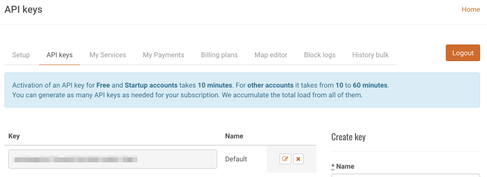
Sign up to request an API key. You should end up in a user settings area where you can select the "API keys" tab. It showed a message about taking 10 minutes to generate keys but then it already had a key immediately generated and ready to go, so... I don't know.
There are a number of ways to request current weather data for your area, but the two most accurate ones seem to be using zip code, and using latitude/longitude:
GET http://api.openweathermap.org/data/2.5/weather?lat=41.4984174&lon=-81.69372869999999&APPID=<your-app-key>

GET http://api.openweathermap.org/data/2.5/weather?zip=44113,US&APPID=<your-app-key>
It returns an abundance of data for the location - you can read about the result values here. Here's the result for Cleveland OH, where it's snowing lightly. There's also a block with other current conditions, such as:
- Tempature, in Kelvin (261.02 K is about 10 Fahrenheit)
- Barometric Pressure, in mm (1038 mm is about 40 inches)
- Humidity, percentage (it's currently snowing so the humidity is high)
- Min and Max temps, in Kelvin (deviation for large geographical areas)
- Visibility, in meters (about 9 miles)
- Wind speed and direction, in m/sec (about 6 mph, due South)
- Cloud cover (currently 90%)
- Timestamp of request (which you can convert to normal time here)
- Timestamps of sunset and sunrise (currently 7:52:43 AM and 5:05:01 PM, respectively)
{
    "coord": {
        "lon": -81.69,
        "lat": 41.5
    },
    "weather": [
        {
            "id": 600,
            "main": "Snow",
            "description": "light snow",
            "icon": "13d"
        }
    ],
    "base": "stations",
    "main": {
        "temp": 261.02,
        "pressure": 1038,
        "humidity": 66,
        "temp_min": 259.15,
        "temp_max": 262.15
    },
    "visibility": 14484,
    "wind": {
        "speed": 2.6,
        "deg": 180
    },
    "clouds": {
        "all": 90
    },
    "dt": 1514472900,
    "sys": {
        "type": 1,
        "id": 2166,
        "message": 0.0045,
        "country": "US",
        "sunrise": 1514465563,
        "sunset": 1514498701
    },
    "id": 5150529,
    "name": "Cleveland",
    "cod": 200
}If you need to lookup the coordinates of a location, check out the Google Maps API - they have an endpoint for just that purpose. You can parse out the geometry/location values and use those in the weather request.
GET https://maps.googleapis.com/maps/api/geocode/json?address=50 Public Square Cleveland, Ohio&key=<your-key>
{
    "results": [
        {
            "formatted_address": "50 Public Square, Cleveland, OH 44113, USA",
            "geometry": {
                "location": {
                    "lat": 41.4984174,
                    "lng": -81.69372869999999
                },
            ...
...The process for getting the 5-day forecast is pretty much the same as current weather, except you get a lot more data - every 3 hours worth, in fact.
GET api.openweathermap.org/data/2.5/forecast?lat=41.4984174&lon=-81.69372869999999&APPID=<your-app-key>
Here's a small portion of the results - there's a dt_txt field that clearly shows that each "block" of JSON data is for a 3-hour interval.
{
    "cod": "200",
    "message": 0.0044,
    "cnt": 40,
    "list": [
        {
            "dt": 1514570400,
            "main": {
                "temp": 264.96,
                "temp_min": 263.056,
                "temp_max": 264.96,
                "pressure": 1006.4,
                "sea_level": 1041.63,
                "grnd_level": 1006.4,
                "humidity": 100,
                "temp_kf": 1.9
            },
            ...
            "dt_txt": "2017-12-29 18:00:00"
        },
        {
            "dt": 1514581200,
            "main": {
                "temp": 264.29,
                "temp_min": 263.016,
                "temp_max": 264.29,
                "pressure": 1005.31,
                "sea_level": 1040.53,
                "grnd_level": 1005.31,
                "humidity": 100,
                "temp_kf": 1.27
            },
            ...
            "dt_txt": "2017-12-29 21:00:00"
        },
        {
            "dt": 1514592000,
            "main": {
                "temp": 261.97,
                "temp_min": 261.333,
                "temp_max": 261.97,
                "pressure": 1005.29,
                "sea_level": 1040.7,
                "grnd_level": 1005.29,
                "humidity": 100,
                "temp_kf": 0.63
            },
            ...
            "dt_txt": "2017-12-30 00:00:00"
        },
        ...
...It's unclear what the usage limits are. The page where you get an app key warns against sending requests "more than 1 time per 10 minutes from one device/one API key", which seems like an extreme limitation. Yet the page that compares price and packages says "no more than 60 calls per minute" for a free account, and thousands or even hundreds of thousands per minute for paid accounts; that seems more reasonable.
There are several ways to get weather data. It's odd that the method they encourage is to use a "city id" - a value you get from a JSON file they provide, but the file is not organized in any particular order and has well over a million lines in it. They also provide a way that uses city and country, but that's inaccurate - I live by Cleveland, OH but there's also a Cleveland, GA. Guess there could be a use-case, and it's there if you need it, I just don't think I'd use it.
The other APIs available for use with a free account are Weather Maps, UV Index, Air Pollution, and Weather Alerts. The last three are still in beta, whatever that means - not sure if that means they're not quite reliable yet? Still would be interesting to try. I could see looking up alerts and then having a Raspberry Pi or similar light an LED or sound a siren for certain conditions.